
Space and climate technology explained
Google FireSat Satellites Explained: How AI Spots Small Wildfires
Three new satellites turn heat, repeat images, and local context into a clearer early-fire signal.
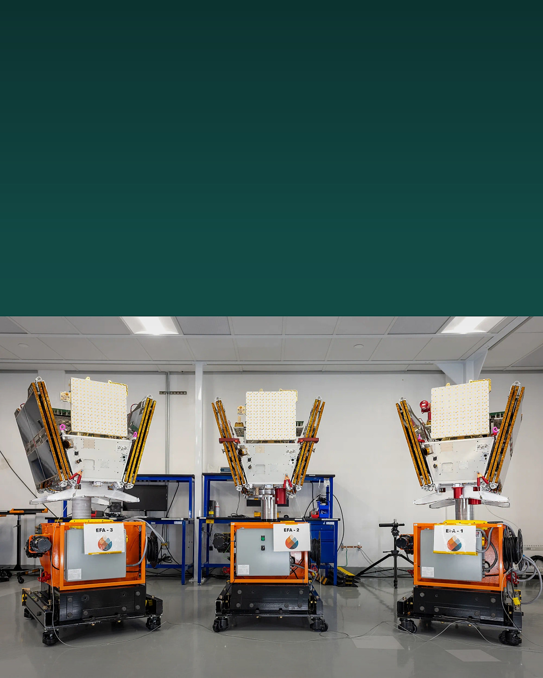
Three operational Google FireSat satellites launched on July 7, 2026. They expand a purpose-built wildfire monitoring program led by the nonprofit Earth Fire Alliance. Muon Space builds and operates the satellites. Google Research contributed to the system design and AI work.
The memorable promise is that the future full constellation is designed to detect a fire as small as 5 by 5 meters, roughly the footprint of a one-car garage or a small classroom, anywhere on Earth with updates every 20 minutes or less. Those numbers describe the planned full network. They do not describe the coverage available from three newly launched satellites today.
Google says the 2025 pilot demonstrated the underlying sensor architecture. It detected a small, relatively cool roadside fire near Medford, Oregon that other space-based systems did not identify. The three 2026 satellites carry that architecture into the first operational group.
BTI did not build, operate, inspect, or independently test FireSat. This guide translates public material from Google Research and its named partners. It separates what launched, what the pilot demonstrated, and what still depends on a larger future constellation.
FireSat quick answer
Most people picture a satellite taking a normal photograph. FireSat looks for heat in several infrared bands. AI then compares the new view with previous views of the same place and adds context such as nearby infrastructure and local weather. The aim is to distinguish a real fire from a warm roof, hot ground, a sensor artifact, or another confusing signal.
One satellite cannot watch every place continuously. A constellation creates more chances to revisit the same ground. That is why the launch count matters. Three operational satellites are a step from one pilot toward a network, but the full global revisit goal needs many more spacecraft deployed in stages.
How Google FireSat satellites turn heat into useful evidence
The system is easier to understand as four connected jobs. Each job also has a limit.
| Step | Plain-English job | What it does not prove |
|---|---|---|
| 1. See heat | Purpose-built infrared sensors observe heat patterns, including small or relatively cool fires. | A heat signal is evidence to analyze, not automatic proof that an emergency is underway. |
| 2. Compare the place | AI compares the new image with earlier views of the same location and considers local context. | The model still depends on sensor quality, reference data, weather information, and validation. |
| 3. Revisit | More satellites can look at fire-prone areas more often than one spacecraft can. | Updates every 20 minutes or less are a goal for the future full constellation, not the current three-satellite service level. |
| 4. Support responders | Fire agencies and researchers can use the resulting imagery and data to understand a developing fire. | A satellite does not dispatch crews, extinguish a fire, or replace local emergency systems. |
What exactly launched on July 7
Google Research says three new FireSat satellites launched from Vandenberg Space Force Base in California. They rode the SpaceX Transporter-17 mission. The hardware was built by Muon Space for Earth Fire Alliance.
The launch expands the program beyond the 2025 protoflight spacecraft. It does not mean the planned global constellation is complete. New spacecraft also need commissioning, calibration, data checks, and integration with the organizations that will use their observations.
That distinction prevents two common mistakes. FireSat is not simply a Google consumer product, and Google did not launch a finished instant global fire-warning service. It is a nonprofit-led space and data program with several named technical and funding partners.
Why infrared matters
Visible light shows what a normal camera sees. Infrared instruments measure energy outside the visible range. FireSat uses high-resolution multispectral infrared imagery. Different bands can reveal active heat, a cooler fire edge, vegetation, smoke context, and older burn scars in different ways.
Google’s first-image report describes a custom mid-wave infrared sensor that found the small Oregon roadside fire. Other images used mid-wave, long-wave, short-wave, near-infrared, and visible-red information to separate active flames from surrounding land and older damage.
Infrared does not make every image perfect. Surface temperature, clouds, sensor angle, atmospheric conditions, and ordinary human activity can complicate a signal. The useful advance is not heat alone. It is purpose-built sensing plus repeated context and a system designed around wildfire behavior.
What the AI actually does
Google Research says the system can compare a current image with the previous thousand images of the same place. It can also consider local weather and nearby infrastructure. That history helps answer a practical question: is this new hot spot behaving like a fire or like something that is normally there?
A model can reduce the amount of imagery people must inspect first. It can score patterns and direct attention. It cannot guarantee that every flagged signal is a fire or that every fire will be detected. Emergency use still needs validation, reliable data delivery, clear thresholds, trained operators, and procedures for false positives and missed detections.
The beginner version is simple. The sensor notices heat. The model asks whether the heat is new and unusual for that location. The network sends evidence that people and response systems can evaluate.
What FireSat does not do by itself
A satellite cannot stop a wildfire. It cannot guarantee an evacuation warning, dispatch an aircraft, place a fire crew, or replace local cameras, weather stations, aircraft, towers, public reports, and other satellites.
Earlier evidence can still matter. A small fire is generally easier to assess and manage than a large, fast-moving one. But the operational benefit depends on the whole chain: detection, confidence, data delivery, agency tools, human judgment, available crews, weather, terrain, and safe response.
FireSat is also not a consumer purchase or investment recommendation. This article contains no price, affiliate link, rating, review, award, stock claim, guaranteed damage reduction, or endorsement.
What the pilot demonstrated
The 2025 protoflight was a test of the sensor design and data workflow. Google says it detected fires on five continents, including the small Oregon fire that other satellite systems missed. The first-image report also showed active fires and old burn scars in Ontario, multiple fires in northern Australia, and remote fires in Alaska.
Google’s July 2026 launch update says the pilot demonstrated potential to detect early-stage fires as small as 5 by 5 meters. That evidence supports the architecture. It does not prove that the current operational network already sees every 5-by-5-meter fire worldwide or refreshes every location within 20 minutes.
The new launch matters because revisit time is a fleet problem. More spacecraft can reduce the wait for another view. The exact service level will depend on how many satellites are operating, where they are, how their sensors perform, and how quickly usable data reaches agencies.
Google FireSat FAQ
How many FireSat satellites launched in July 2026?
Google Research says three operational FireSat satellites launched on July 7, 2026. They followed a separate protoflight satellite launched in March 2025.
Can FireSat already scan the whole Earth every 20 minutes?
Google describes updates every 20 minutes or less as the goal when the full constellation is operational. The full network will be deployed in stages. BTI has found no official claim that the three newly launched satellites already provide that global cadence.
What does 5 by 5 meters mean?
It is the smallest-fire target Google gives for the full constellation and the scale the pilot architecture demonstrated potential to detect. It is roughly the footprint of a small classroom or one-car garage.
How does AI help detect a wildfire?
Google says AI compares a current infrared image with earlier images of the same place and considers local weather and infrastructure. That context helps distinguish a new fire-like heat signal from ordinary background heat or noise.
Who runs FireSat?
Earth Fire Alliance leads the program. Muon Space builds and operates the satellites. Google Research contributed to the design and AI work. Google.org and other philanthropic organizations have funded the effort.
Official FireSat sources
- Google Research July 7 launch update: The official announcement that three operational FireSat satellites launched from Vandenberg.
- Google Research FireSat program page: The sensor, AI-comparison, future constellation, partner, and funding overview.
- Google Research first FireSat images: The 2025 pilot examples, infrared-channel explanation, Oregon detection, and future 5×5-meter goal.
- Google Research FireSat origin story: How the partners tested sensors and trained the system to distinguish fires from environmental noise.
BTI final take
FireSat is interesting because the hardware, AI, and network each solve a different part of the problem. Infrared sensors look for heat. AI asks whether the heat is unusual. A constellation reduces the wait for another view. Response organizations decide what to do with the evidence.
Save the careful version: three operational satellites launched; one pilot already demonstrated the sensor architecture; the 5-by-5-meter and 20-minute global goals describe the future full constellation. That is still a meaningful step toward seeing a small fire before it becomes an enormous one.
Follow BTI for the next plain-English tech breakdown
BTI turns current tech stories into simple buyer and science explainers without claiming hands-on testing, prices, ratings, or availability.